After The Storm:
Feeling the need to inspire myself and put my camera to use, especially after the recent purchase of the Nikon Z 14-30mm f/4 S lens for an upcoming trip to the Sonoran Desert, I found myself eager to justify the investment. Although the lens had yet to arrive, I decided to embark on a short trip to Falls Lake in Wake Forest, North Carolina, for a sunset shoot.
It was a beautiful, warm afternoon with clear blue skies and wispy clouds in the high altitudes. Unexpectedly, a rogue storm swept through Raleigh, catching me off guard while on the 540 (northbound) en route to the Falls of Neuse exit. My initial reaction was disbelief—how could I transition from clear blue skies with wispy clouds to a torrential downpour with lightning in the span of just 10 miles?
My wife called; there were trees down in the neighborhood; I couldn't believe my luck! However, the sunset was scheduled for 20:22 hours, and according to the weather map, this cell would blow over Falls Lake by 20:10—so I decided to sit it out; this was the end result.
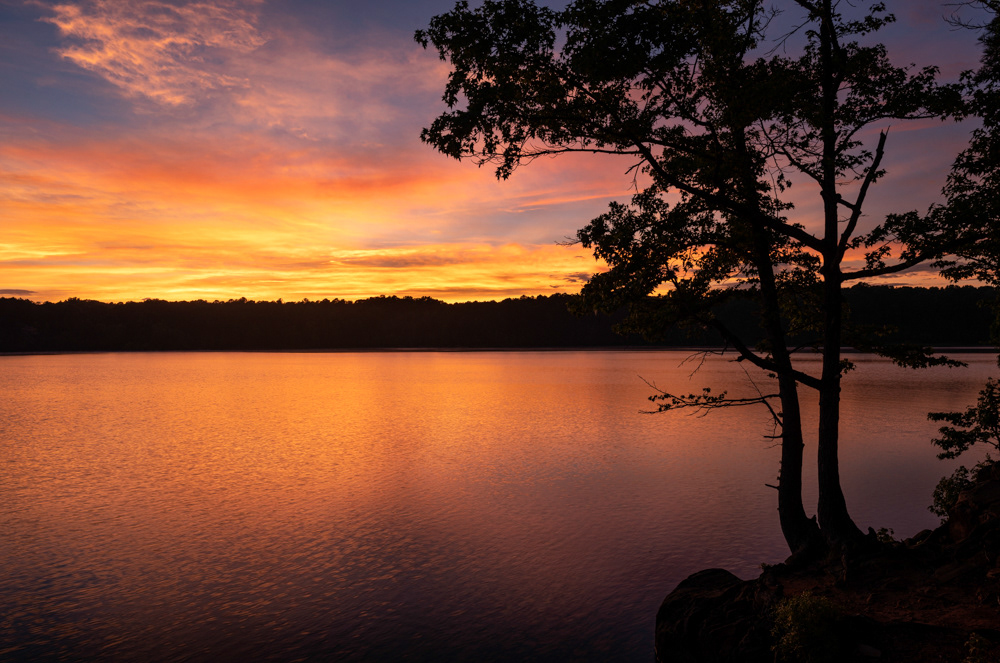
After a freak storm, the sun sets below the horizon at Falls Lake, Wake County, North Carolina. This image was captured with the Nikon Z 7II using the Nikkor Z24-70mm f2.8 S. The focal length was 24mm, f/11, 1/3 second at ISO 64. Falls Lake is a 12,410-acre reservoir in Durham, Wake, and Granville counties in North Carolina. Falls Lake extends 28 miles up the Neuse River to its source at the confluence of the Eno, Little, and Flat rivers. The lake is named for the Falls of the Neuse, a once whitewater section of the river that fell from Piedmont into the lower Coastal Plain, submerged during the lake's construction. The lake provides drinking water for several of the surrounding communities, including the city of Raleigh, aids with flood control, and serves as a recreation area and wildlife habitat. Work on the lake's dam began in 1978 and was completed in 1981; before its construction, flooding of the Neuse River caused extensive damage to public and private properties, including roadways, railroads, industrial sites, and farmlands. The U.S. Army Corps of Engineers constructed the dam, which is 291.5 feet high, and 1,915 feet long. The height above the streambed is 92.5 feet.
I don't usually lean towards oversaturating images in post-processing, particularly when it comes to sunsets. Instead, I aim to exercise tight control over the saturation slider, ensuring it merely matches the scene's colors at the time of capture. However, the hues during this particular sunset at the lake were visually overwhelming, both in-camera and when I reviewed the RAW files on my computer. I even contemplated reducing the intensity to tone it down, but ultimately, I made the decision to leave the photograph as is.