In The Footsteps Of The Apache:
Nothing quite stimulates the imagination more than the American West! Cochise and Geronimo, Wyatt Earp and Doc Holiday, Yuma and Tombstone—tough characters associated with tough frontier towns. Infamous names that ultimately left an indelible mark on history. In the 1960s, Hollywood presented an alternate version of the West: open frontiers, heroes and romance, cowboys and Indians, boundless heroism, defending the lonely homesteader from hordes of blood-thirsty savages. In reality, Arizona and New Mexico in the 1850s and early 1860s were, for many, unbearable hardships. People grappled with eking out a living in a rocky, arid landscape covered in prickly cacti, all while caught up in a deadly dispute with the indigenous tribes that lived there.
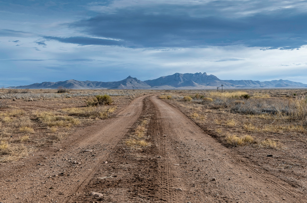
The early morning drive—heading east from Arizona Highway 186 (SR-186) towards the Chiricahua Mountains, part of the Chiricahua National Monument, managed by the National Park Service.
In the mid-nineteenth century, pioneers drawn westward by California's goldfields charted a trail that took them through Apache Pass and its freshwater spring. The pass separated the arduous Dos Cabezas mountains to the north and the Chiricahua Mountains to the south. This little creek became a desert oasis for all those traveling West, ultimately leading to a clash of cultures between the Chiricahua Apache, led by charismatic leader Cochise, and the numerous migrants pouring in from the East. Thousands of Union soldiers and valuable military resources were assigned to the Arizona territory to protect the pass, establish the water rights, and defeat the Apache during the American Civil War. The decade-long war that followed, with Cochise and his band of Apache, and the events that preceded Fort Bowie's construction, are described in the project 'Fort Bowie (1862 – 1894).'
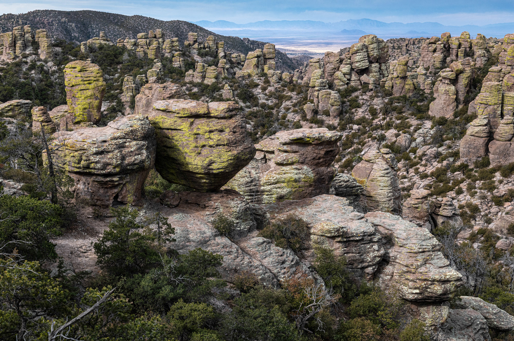
The view of Bonita Canyon (looking southwest), hiking Massai Point Trail, within the Chiricahua Mountains, southwest of Massai Point, at the Terminus of the East Bonita Canyon Road.
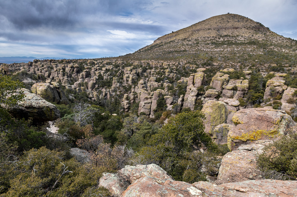
The Chiricahua Mountains are an extensive range in southeastern Arizona, part of the Basin and Range province of the West and the southwestern United States and northwest Mexico. They were home to several Apache tribes, who traveled north to Apache Pass, utilizing the Pass and its water as a camping spot in winter and spring. As the conflict in southeastern Arizona made headlines across the country, the United States Army managed to curb Apache migration within these mountains. The sustained fighting took a toll on the Apache and the federal troops alike. Regardless, the Chiricahua took full advantage of fighting on home soil; their primary defensive positions were among these rocks and boulders.
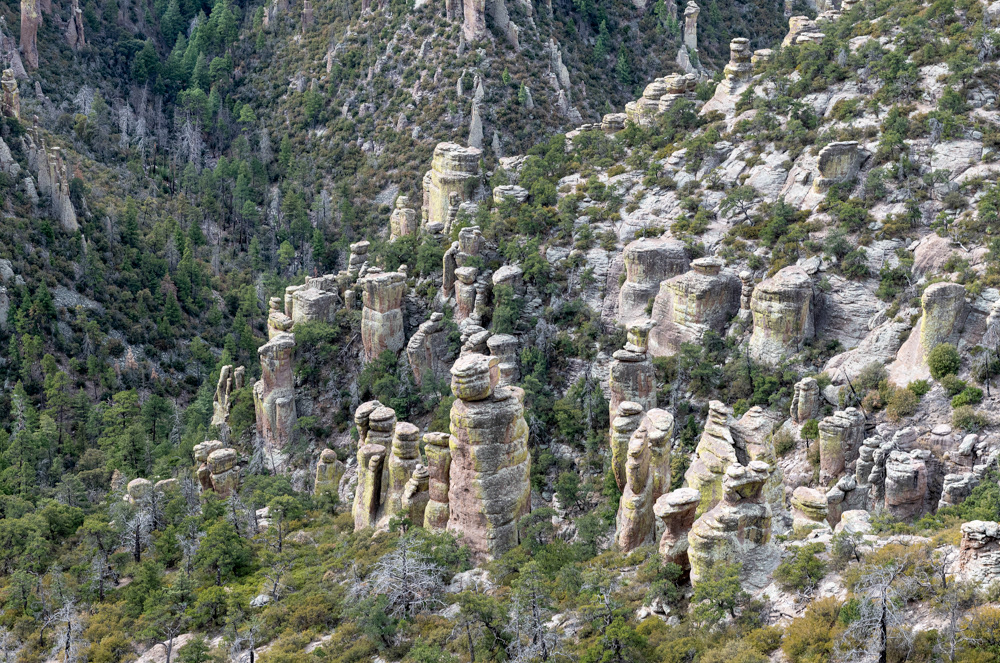
Bonita Canyon looking east.
Today, the Chiricahua Mountains are part of the Coronado National Forest in Cochise County, Arizona, roughly 50-miles southeast of present-day Wilcox. This rugged natural fortress formed one of the two primary resistance spots during the Indian Wars, the other—the Dragoon Mountains, under Cochise. For over a decade, the Apache would fend off the U.S. military from these fortifications and wage a war that vibrated throughout the corridors of power in Washington D.C.
The standoff with Cochise, which lasted over a decade, was an embarrassment for the U.S. Army. All their operations had been ineffective against Cochise and his people. In October 1872, General Oliver Howard, who had been sent to the Arizona territory by President Ulysses S. Grant to review the existing conditions on reservations, met with Cochise, hoping to reach a peaceful end to the struggle. The parties met over several days and consummated a treaty. After which, Cochise called in his sub-chiefs to present the new peace proposal. On October 12, 1872, Cochise announced, "Hereafter, the white man and the Indian will drink the same water, eat the same bread, and be at peace." Cochise kept the treaty until his death on June 8, 1874.
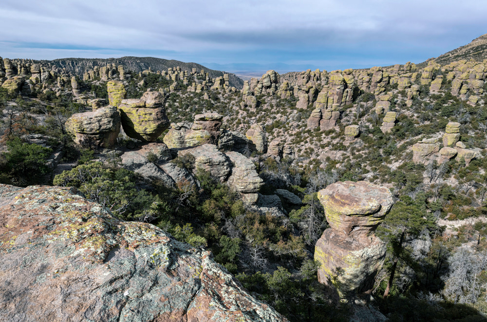
The view southwest across Bonita Canyon.
Before Spanish colonization, the Apache territory extended thousands of miles through (what is now) east-central and southeastern Arizona, southeastern Colorado, southwestern and eastern New Mexico, western Texas, and the Chihuahua and Sonora regions of northern Mexico. Most people envision the Apache territories as desert wastelands of unbearable heat, poisonous reptiles, and stinging cactus. Although these places exist, there are also endless grasslands, forested slopes, and mountainous peaks as mysterious as the people themselves. In these mountain ranges, the people hunted game, foraged medicine, good water, shelter, and took refuge from the heat. These lands were sacred to the people; they fought for 200 years to keep them and protect their way of life! First with the Spaniards, then the Mexicans, and finally the Americans.

The view south across Echo Canyon.
The view northeast across Echo Canyon to Sugarloaf Mountain.
Their stories are chronicled in countless tales of bravery, cunning, and endurance. The names of war chiefs such as Cochise, Mangas Coloradas, Geronimo, and Victorio will forever remain in American history. As I retrace their footsteps, I cannot help feeling that the spirits of their forefathers are watching over me, judging my intentions with prying eyes, and that angry gods will punish me if I abuse these sacred haunts. Throughout the Chiricahua Mountains, this country's untamed wilderness can still be felt—along the length and breadth of these peaks, around every turn in the rocks, and in every gully. For over two decades, people slaughtered one another here. Today, there is still an eerie presence of those who have gone before.
Google Maps: 32.006593, -109.312633