Sonoran Desert:
On January 17, 2001, a Presidential proclamation transformed a 496,400-acre wilderness zone into the Sonoran Desert National Monument, managed by the US Bureau of Land Management as part of the National Landscape Conservation System. Renowned as the most biologically diverse of the North American deserts, the Sonoran Desert is encapsulated within this monumental expanse, showcasing the unrestrained beauty of a desert landscape. The area, situated far from the beaten path, emanates a sense of isolation and desolation. Characterized by long ridges and isolated peaks interspersed with bajadas and wadis, the wilderness region poses a myriad of challenges—everything out there has the potential to bite, poke, prick, sting, or inject venom. During the peak of summer, with temperatures averaging 112°F, this desert region is unforgiving and often underestimated by many, leading to fatal consequences.
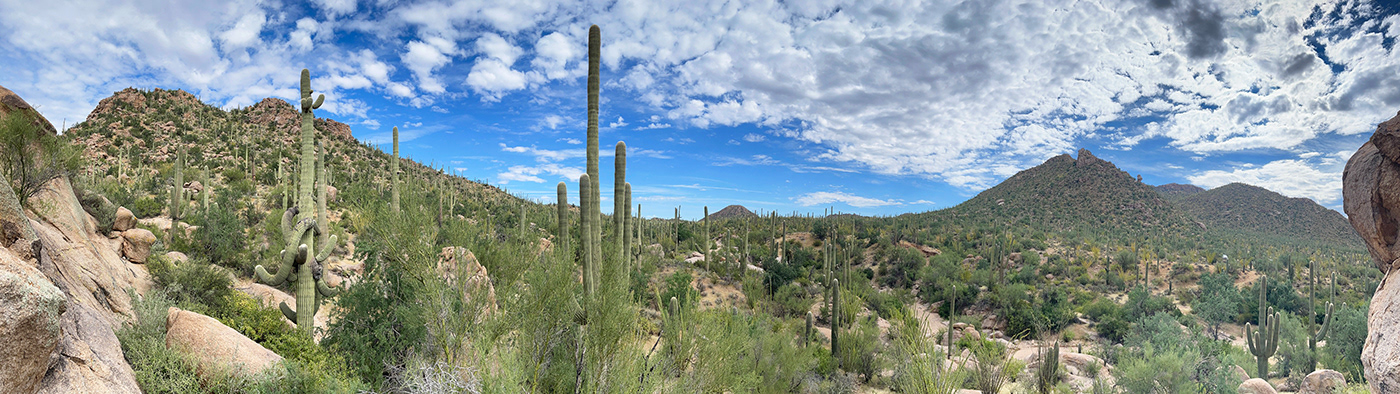
The monument encompasses three distinct mountain ranges—the Maricopa, Sand Tank, and Tabletop Mountains – along with the Booth and White Hills, all separated by expansive valleys. This region is divided into three Congressionally designated wilderness areas and features numerous significant archaeological sites as well as remnants of several important historic trails. Despite these notable attributes, the most striking aspect of the monument lies in its vast saguaro cactus forests.

A typical landscape view of the Sonoran Desert, barren and unforgiving, where Saguaro cacti stretch as far as the eye can see.
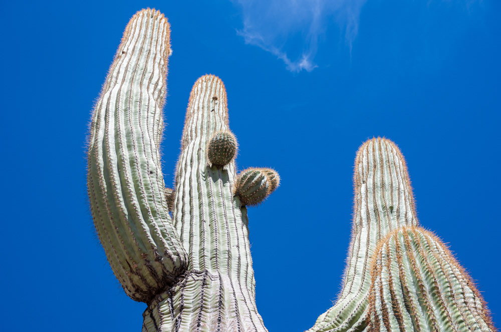
The saguaro cactus (Carnegiea gigantea) is one of the defining plants of the Sonoran Desert. These plants are giant, tree-like columnar cacti that develop branches as they age; these branches generally bend upward—although some plants may never grow limbs. Saguaros are covered with protective spines, bloom white flowers in the late spring, and red fruit in summer. With the right growing conditions, it is estimated that saguaros can live as much as 150-200 years old. Saguaros grow slowly; a young cactus may only grow 1 to 1.5 inches in its first eight years, while an adult saguaro can reach 60 feet. The amount of available water impacts their growth.

Standing in a forest of these living ancients that started growing in the late 1700s was an incredibly humbling feeling. As far as saguaros go, statistically, the tallest one ever measured was 78 feet tall around Cabe Creek, Arizona; it toppled in 1986 during a windstorm. The oldest saguaro recorded was 'Old Granddaddy,' estimated at 300 years old when it started to die in the 1990s, making it the oldest known cactus worldwide. Not only was Old Granddaddy old, but it was also a giant at over 40 feet tall and had 52 arms.
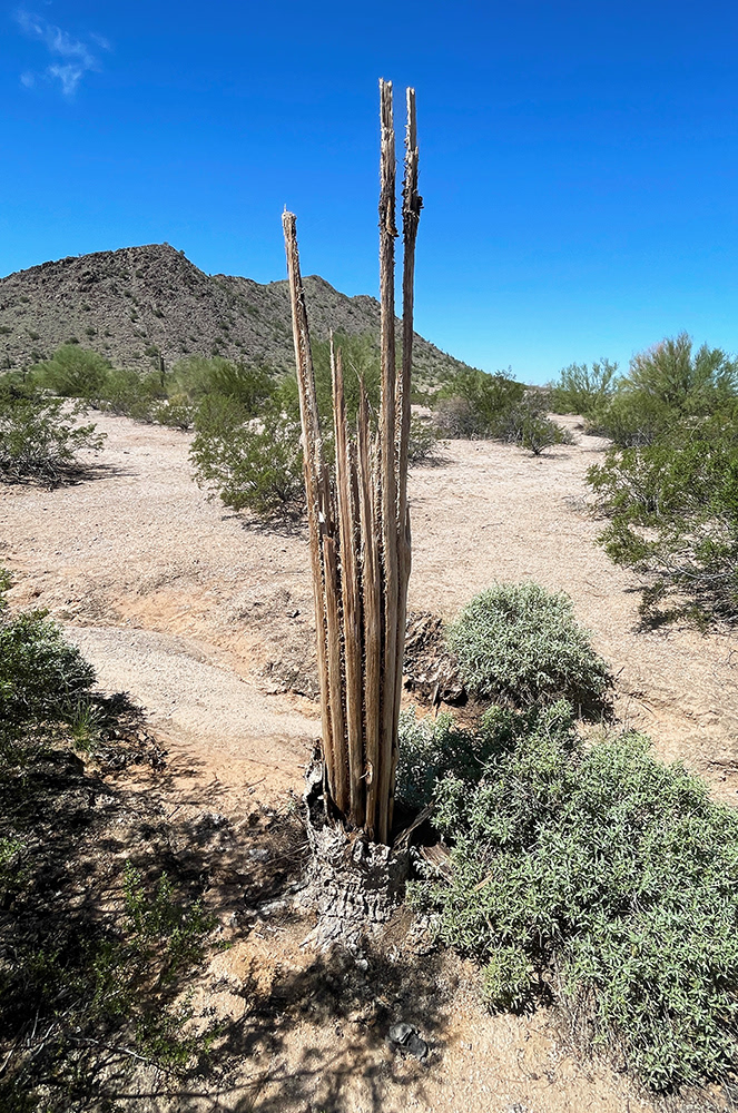
The inner accordion-like ribs of a dead saguaro were once a mechanism used by the plant to store hundreds of gallons of water; now, these ribs are strong dry strands of wood with many uses. Several local bands of Apache believe that the saguaro is their ancestors, that have returned to watch over the land in the afterlife. And while using the ribs for construction, tools, and fencing is acceptable, they can never be used as firewood.

Cactus spines are painful, and puncture sites can become infected like any other kind of wound in a desert environment. I have learned with experience to be mindful of what I grab for as I slip, stumble, or fall.
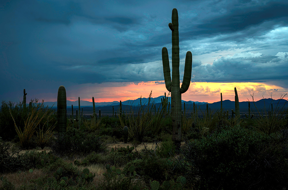
Stormy Sunset

Crossing the Gillespie Bridge heading west. The Gillespie bridge is a through-truss bridge spanning the Gila River in Maricopa County. The bridge was constructed in 1925 and was completed in 1927.

Crossing the Gillespie Bridge.

Standing under this impressive span, it's hard to imagine that the water could rise this high, but it is, after all, officially named the Gillespie Dam bridge.

Ferocactus is a genus of large barrel-shaped cacti, mostly with large spines and small flowers. There are about 30 species included in the genus. They are found in the southwestern United States and northwestern Mexico.

Bee Kind
References:
Gila Bend (U.S. National Park Service). (n.d.). Gila Bend (U.S. National Park Service). https://www.nps.gov/places/gila-bend.htm