
The Dragoon Mountains, Arizona.
The Dragoon Mountains:
North of Tombstone, Arizona, lies a mountain region known as the Dragoons, celebrated as the stronghold for the charismatic Chiricahua Apache Warrior, Cochise. These mountains provided Cochise with year-round access to water, food, and herbal medicines. To the uninitiated, the picturesque granite spires and sheer cliffs create chasms of rocky chaos that serve as a natural maze and fortress for the Apache. From these elevated vantage points, Cochise enjoyed incredible views of the Sulphur Springs Valley to the east and the San Pedro Valley to the west, providing excellent early warning; he could spot the U.S. Cavalry coming days in advance!
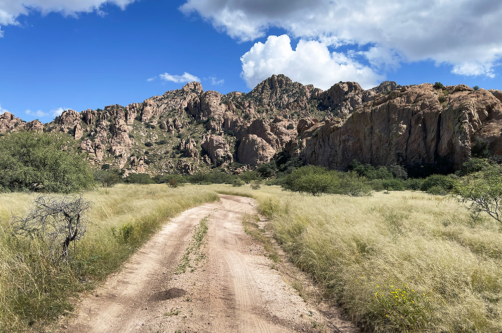
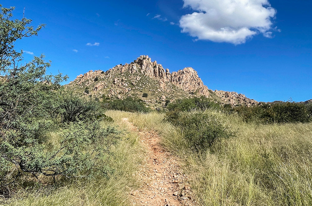
The Dragoon Mountains seen from dirt road 687 off Middlemarch Road, heading north.
Deep within these mountains lies a formation of rocks known as 'Council Rocks.' Situated on the western edge of the Dragoons, 9 miles south of Dragoon Springs (a stagecoach station utilized by the Butterfield Overland Mail from September 1858 to March 1861), Council Rocks is a formation believed by many historians to be an ancient meeting place. In addition to its commanding view, it possesses a natural amphitheater-like characteristic. This site would have held the same significance to the Apache as the United States Capitol meant to those who pursued them. One can only imagine the issues discussed in a time of fear, on the brink of losing one's way of life, embroiled in an 11-year bloody struggle against an ever-expanding eastern culture. Archaeologists have dated human presence around these rocks a thousand years before the Apache. The site is now listed on the National Register of Historic Places.
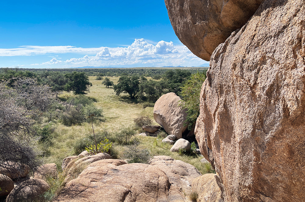
The San Pedro Valley.
Yet, despite its prehistoric significance, I find myself drawn to more recent history as I stand in the footsteps of Cochise and his council members. This place exudes an eerie spiritual feeling. Among these angular peaks, within this labyrinth, the Apache applied guerrilla tactics against the U.S. Army; is it any wonder the government was eager to make peace after 11 years of warfare on the Arizona frontier? Some historians suggest that it was at Council Rocks that General Oliver Otis Howard negotiated the Broken Arrow Peace Treaty with Cochise on October 12, 1872. However, according to Howard's memoirs and his description of the area (quoted at the end of this piece), others argue it is Slavin Gulch, a few miles further south.
Over time, little has changed; the views are still endless, stretching for miles across the deep-grassy meadows of the Sulphur Springs and San Pedro Valleys. Yet, standing amid these granite spires—gazing toward an infinite horizon, I find myself drifting between eras. A soothing silence fills the air; I feel a chill in my spine as I stand in the footsteps of those who have stood before me, scanning the horizon for dust clouds—looking for the U.S. cavalry!
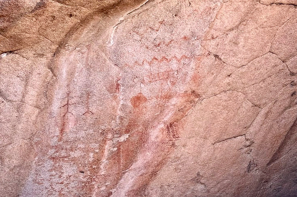
Red and orange pictographs in the area are reminiscent of designs used by prehistoric Mogollon peoples roughly 1000 years ago—and were later augmented by the Apache. Unfortunately, they have faded with time and are now very fragile. Nevertheless, these boulder formations have provided shelter for travelers passing through this area for over a thousand years!

Crossing the Dragoon mountains from east to west required the United States military to transit a labyrinth of gullies and crevices', ideal ambush positions for the Apache.

The geology of the Dragoons is dominated by spectacular lichen–covered granitic rock formations that have been beautifully weathered and sculptured. Significant areas of limestone are also present.
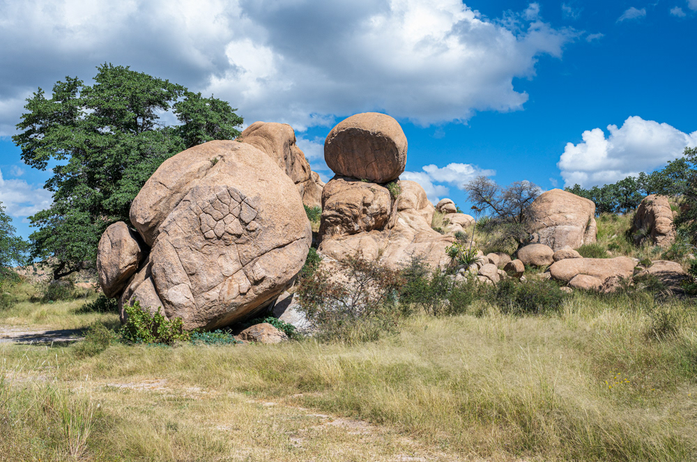
Boulder formations, showing millions of years of geology at Slavin Gulch, an area believed by many historians to be the location of the Broken Arrow Peace Treaty on October 12, 1872.
Following the original path of the 3rd U.S. Cavalry Dragoons (from which these mountains were named) into this maze of rocks, where they would first encounter Cochise and his Chiricahua Apache during the Apache Wars.
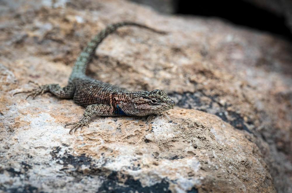
Sceloporus Jarrovii, also known commonly as Yarrow's spiny lizard, is a species of lizard in the family Phrynosomatidae. The species is native to the southwestern United States and northern Mexico.

General Sherman and his Staff: Standing, left to right: Oliver Otis Howard, William Babcock Hazen, Jefferson Columbus Davis, Joseph Anthony Mower. Seated left to right: John Alexander Logan, William Tecumseh Sherman, Henry Warner Slocum. (Image Credit: Library of Congress, Prints and Photographs Division, Washington, D.C.)
General Oliver Otis Howard: "Conceive yourself standing beneath a cluster of oaks on a plateau of grassland, facing westward, with a high mountain behind you, toward your right a wall of sandstone rock almost perpendicular, presenting somewhat the appearance of an old castle in ruins. A few hundred yards in front, a stream of water clear as crystal. Beyond a series of ravines with mesas or tablelands between, mainly parallel to the stream and the mountain range. Six or seven miles distant, apparently much less, there arose a globular height 300 feet out of the plain entirely independent of other hills, beyond it the river San Pedro."
~ General Oliver Otis Howard, October 1872.
Image Source:
(1865). Sherman and Generals. Library of Congress Prints and Photographs Division Washington, D.C. . https://www.loc.gov/pictures/item/2018667368/